Get consult
Unlock the secrets of the world’s most breathtaking locales with our expert insights — guiding you toward the truly remarkable destinations that define a lifetime of travel.


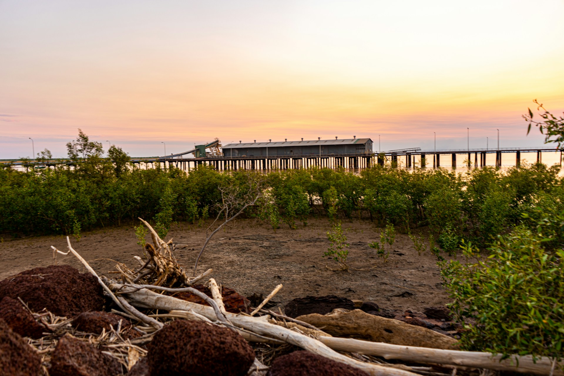
Photo by Ben Carless on Unsplash
There are very few places on earth where the landscape can genuinely make you feel like you are standing at the beginning of time. The Kimberley is one of them. Covering 423,000 square kilometers in the far north of Western Australia, larger than Germany, it holds rock formations that are 350 million years old, Aboriginal rock art that predates the Egyptian pyramids, one of the most extreme tidal phenomena on earth, gorges carved over geological epochs that no human hand has touched, and a coastline stretching more than 12,000 kilometers that remains, in most places, entirely untouched by development. The Kimberley is not a destination you visit in transit. It is a destination that rearranges your sense of scale.
In 2026, Western Australia is recording the strongest tourism performance in its history. Western Australia welcomed a record 1.02 million international visitors in the 12 months to October 2025, surpassing pre-pandemic benchmarks and achieving recovery two years ahead of projections made by Tourism Research Australia, as confirmed by Travel and Tour World citing official Tourism Western Australia data. Total visitor expenditure across Western Australia reached 19.2 billion AUD in 2025, with 11 million overnight visitors and more than 29 million day-trippers, as confirmed by Travel and Tour World citing Cook Government data. International seat capacity into Western Australia reached 131 percent of January 2019 levels by January 2026, as confirmed by Travel and Tour World. Within this boom, the Kimberley is drawing its specific share of a new traveler profile. High-end expedition cruises along the Kimberley Coast have seen record bookings in 2026 as travelers seek the rugged, untouched beauty of the far north, as confirmed by Travel and Tour World's Western Australia 2026 tourism analysis. Tourism Western Australia's new Munbula Cruise debuted at El Questro in 2026, a three-hour Chamberlain River journey led by Ngarinyin Traditional Owners sharing Dreaming stories and insights into sacred Kimberley landscapes, as confirmed by Tourism Western Australia's official 2026 What's New guide.
The trend driving the Kimberley's specific appeal in 2026 is Remote Wilderness and Indigenous-Led Adventure Tourism: a combination of extreme landscape immersion, Aboriginal cultural encounters on Country, and high-value expedition experiences that cannot be replicated anywhere else on the Australian continent or, frankly, anywhere else on earth.
The Kimberley is one of the most ancient continuously inhabited landscapes on earth. Aboriginal peoples have lived in the Kimberley for a minimum of 45,000 years, as documented by Odyssey Traveller's Kimberley Aboriginal heritage guide and corroborated by genetic and archaeological research cited in the Histories of Rock Art research published through ResearchGate. The oral tradition of Kimberley Aboriginal peoples states, as their primary origin narrative, that they have always been on Country, a position now supported by both genetic research and archaeological reconstructions, as confirmed by ResearchGate's peer-reviewed documentation. When first encountered by European explorers, there were at least 50 Aboriginal language groups spoken in the Kimberley, as documented by the Histories of Rock Art research. Today the major language groups including the Djugun, Yawuru, Bardi, Bunuba, Gooniyandi, Wunambal, and Ngarinyin peoples maintain deep spiritual, cultural, and custodial relationships with Kimberley Country, as confirmed by Pilot Guides and Australia's North West's Indigenous heritage documentation.
European contact began in earnest in the 1830s, when explorer George Grey's expedition encountered Wandjina rock art in 1838, as confirmed by the Histories of Rock Art research. Grey's first physical encounter with local Aboriginal people was disastrous: his party was attacked after failing to follow established cultural protocols for entering others' Country. The colonial period brought pastoral stations, forced displacement of Aboriginal peoples from their traditional lands, and the trauma of the cattle industry, which used Aboriginal stockmen and domestics while denying them rights to their own land, as documented by Australia's North West's Gibb River Road cultural guide. Today 13 Aboriginal ranger groups across the Kimberley are formally engaged in caring for Country through Indigenous Protected Areas and Aboriginal Corporations, as confirmed by the Histories of Rock Art research. The Kimberley's tourism transformation toward Indigenous-led experiences is not a marketing angle: it is the outcome of Aboriginal communities asserting custodianship over their own cultural heritage and developing the visitor economy on their own terms.
The Kimberley contains one of the world's most substantial bodies of Aboriginal rock art, extending across stylistic phases from the present day back to at least 12,000 years ago for the oldest directly dated examples, with many researchers placing earlier phases significantly further back, as confirmed by Science Advances peer-reviewed dating research. Two major traditions dominate. The Gwion Gwion (also called Bradshaw or Gyorn Gyorn) paintings, first encountered by European eyes in the late 1890s, depict extraordinarily detailed stick-like human figures adorned with tassels, sashes, and ornaments in a style that represents some of the earliest figurative art ever documented, as confirmed by Australia's North West's rock art guide. The Wandjina, the Supreme Being spirits for the Worrora, Ngarinyin, and Wunumbal peoples, are depicted as large, iconic figures with round heads, wide eyes, and no mouth, surrounded by halo-like rays. These are living, spiritually active figures to their custodian communities: the Wandjina are not historical art. They are ongoing presences whose images require maintenance and whose stories are still practiced through ceremony, as confirmed by Australia's North West and the Mowanjum Aboriginal Art and Cultural Centre's documentation. The Mowanjum Aboriginal Art and Cultural Centre, located 15 kilometers outside Derby, is the primary public gateway to Wandjina and Gwion Gwion culture, managed by the Worrorra, Ngarinyin, and Wunumbal peoples themselves. Rock art sites along the Gibb River Road, including Galvans Gorge, Manning Gorge, and Adcock Gorge, are accessible to self-drive visitors, while more remote sites on the Mitchell Plateau and Kimberley Coast require guided access with Traditional Owner operators, as confirmed by Australia's North West's rock art guide.
One of the Kimberley's most remarkable stories is how recently the outside world discovered its most famous geological feature. The Bungle Bungle Range, the extraordinary 45,000-hectare landscape of orange-and-grey-banded beehive-shaped sandstone domes rising up to 250 meters above surrounding savannah in the east Kimberley, was almost entirely unknown outside of the Gija and Jaru peoples whose cultural connection to the area spans tens of thousands of years, until an airborne film crew captured it for a documentary called Wonders of Western Australia in 1983, as confirmed by Silversea's Kimberley heritage guide and DCCEEW's Purnululu heritage documentation. Purnululu National Park was declared in 1987 and UNESCO-inscribed in 2003 as the most outstanding example of cone karst in sandstone anywhere in the world, covering 239,723 hectares, as confirmed by the UNESCO World Heritage Centre's official Purnululu listing and Wikipedia's Purnululu article. The sandstone is Devonian-age, approximately 350 to 360 million years old, as confirmed by the Purnululu UNESCO listing. The distinctive banding is created by alternating layers of cyanobacteria (the grey bands) and iron-oxide-rich sandstone that dries too quickly for cyanobacteria to colonize (the orange bands), as confirmed by Wikipedia's Purnululu article. More than 600 plant species, 149 bird species, 85 reptile species, 32 native mammal species, and at least one endemic lizard species (Lerista bungle bungle) inhabit the park, as confirmed by the WA Department of Biodiversity, Conservation and Attractions. In February 2025, plans were announced for new premium tourism accommodation in the park, due to open by 2027, as confirmed by Grokipedia's Purnululu documentation.
The Kimberley has two primary air gateways. Broome Airport (BME), located less than 1 kilometer from the center of Broome, is the western gateway and the most common entry point for international and interstate travelers. East Kimberley Regional Airport in Kununurra (KNX), 3 kilometers from town, is the eastern gateway and the base for visiting the Bungle Bungles and El Questro. Both airports receive domestic flights from Perth and Darwin year-round, with Brisbane and Sydney direct flights available during the dry season from April through September, as confirmed by Tourism Australia's official Kimberley guide. Broome is approximately 2,240 kilometers north of Perth by road, making it a 2-hour flight from Perth but a 24-plus-hour drive: fly in unless you are specifically planning a full west coast road trip. International travelers connect via Perth International Airport (PER). The 660-kilometer Gibb River Road connecting Derby (220 kilometers northeast of Broome) to Kununurra crosses the entire Kimberley interior and is the primary overland route for independent 4WD travelers, as confirmed by Australia's North West's Gibb River Road guide.

The Gibb River Road is one of the great outback drives in the world and the spine of any independent Kimberley adventure. Originally constructed in the 1960s to transport cattle from outlying stations to the ports of Derby and Wyndham, the 660-kilometer road is unsealed, corrugated in sections, crosses multiple creek beds, and is accessible only by large 4WD vehicles, as confirmed by Australia's North West's comprehensive Gibb River Road guide and The Kimberley Collection's road guide. The road is not suitable for caravans, trailers, or 2WD vehicles. Average traveling speed is 60 to 80 kilometers per hour, as confirmed by The Kimberley Collection. The road opens after the wet season, typically in late April, and can normally be driven through to late September. Allow a minimum of 10 to 14 days to do the Gibb justice: the gorges, stations, and waterfalls along the route including Dalmanyi (Bell Gorge), Adcock Gorge, Galvans Gorge, Manning Gorge, and Windjana Gorge require time to reach and explore properly, as confirmed by Australia's North West and 4WDing Australia's Kimberley guide. Essential equipment includes a spare tyre (ideally two), extra fuel (many sections have no fuel for over 250 kilometers), extra water, a personal locator beacon (PLB) or satellite phone, and a high-lift jack. Silent Grove campground near Bell Gorge and Windjana Gorge campground can now be booked online 180 days ahead: book early during peak season, as confirmed by 4WDing Australia.
Purnululu is located 304 kilometers from Kununurra and 160 kilometers from Halls Creek by road, with the last 53 kilometers consisting of rugged, 4WD-only terrain that takes approximately 2 hours to cover, as confirmed by Explore Parks WA's official Purnululu page. The park is open during the dry season from approximately April through November (subject to weather and road conditions). Allow at least two nights: the park is 47 kilometers from its northern end to its southern end, an 80-minute drive, and the two main attraction zones, the northern Echidna Chasm and Mini Palms area, and the southern Cathedral Gorge and Piccaninny Creek area, each require half a day, as confirmed by Explore Parks WA. Two campgrounds, Kurrajong and Walardi, are available inside the park with no nearby shops: carry all food and water, as confirmed by Everything-Everywhere's Purnululu guide. Helicopter flights over the Bungle Bungles from either the park itself or from Kununurra provide the most dramatic visual experience and are strongly recommended for those who can access them, particularly early morning when the domes reflect the low-angle sunlight at its most vivid. The visitor center in the park is the required check-in point and provides current conditions, trail information, and cultural context for the Gija and Jaru peoples' connection to the landscape.
The Kimberley's Indigenous-led tourism sector offers some of the most meaningful cultural encounters available anywhere in Australia. In 2026, the following are confirmed operating experiences. The Mowanjum Aboriginal Art and Cultural Centre, 15 kilometers outside Derby, is managed by the Worrorra, Ngarinyin, and Wunumbal peoples and provides the most accessible introduction to Wandjina and Gwion Gwion rock art traditions, with gallery visits, guided explanations, and locally produced artworks for purchase, as confirmed by Australia's North West. The Munbula Cruise at El Questro, debuting in 2026 and led by Ngarinyin Traditional Owners, is a three-hour journey along the Chamberlain River sharing Dreaming stories and insights into sacred landscapes, as confirmed by Tourism Western Australia's 2026 What's New guide. At Mimbi Caves near Fitzroy Crossing, Gooniyandi guides lead tours of one of Australia's most spiritually and geologically significant sites, as confirmed by Australia's North West. At the Mitchell Plateau, Uunguu Rangers and Traditional Owners now offer guided tours through the Munurru Rock Art Sites from Munurru Campground, as confirmed by Australia's North West. Entry permits (free) are required for visitors to Kalumburu and other Aboriginal Reserve areas: apply before leaving your base, as confirmed by Australia's North West's rock art guide. At all rock art sites: stay on marked walkways, do not touch the paintings, remove backpacks in confined spaces, and carry nothing that may brush against the art.
The dry season from May through October is the only viable time for most Kimberley travel, as the wet season from November through April brings flooding, road closures, and extreme heat that make most inland travel impossible, as confirmed by Destination Kimberley's weather guide and Tourism Australia's Kimberley guide. June is widely regarded as the single best month: everything is open, the country is still lush and green from the wet season, temperatures are ideal, waterfalls are still flowing strongly, river and creek crossings are manageable, and tourist volumes are lower than the peak July to August period, as confirmed by Destination Kimberley's month-by-month analysis. July and August are peak season, with Broome's school holidays and the Broome Cup (mid-August) creating maximum demand: book accommodation 6 to 12 months ahead for peak period visits. Budget ranges vary enormously by travel style. Independent 4WD camping travelers can explore the Kimberley for approximately 150 to 250 AUD per day covering fuel, camping fees (typically 17 to 30 AUD per night at sites with facilities), and food, as confirmed by 4WDing Australia and Let's Escape Together's road trip cost breakdowns. Mid-range travelers using guided tours and station accommodation can expect 350 to 600 AUD per day. Luxury expedition cruise and glamping visitors should budget from 800 to 2,000 AUD or more per day. Currency is the Australian Dollar. Carry significant cash reserves: ATMs are available only in the major hubs of Broome, Derby, Fitzroy Crossing, Halls Creek, and Kununurra, and EFTPOS facilities are absent across most of the Kimberley interior. Mobile coverage is available only in and around major towns: carry a PLB or satellite phone for any remote travel, as strongly recommended by Explore Parks WA and Let's Escape Together.
The Kimberley is not a theme park. It is a living cultural landscape where Aboriginal peoples have maintained unbroken spiritual and custodial relationships with Country for 45,000 years, and where the physical environment, the gorges, the rock art galleries, the sandstone formations, the rivers, the saltwater crocodile populations in tidal estuaries, the freshwater crocodiles in inland gorges, are all active, functioning ecosystems rather than scenic backdrops. Approaching the Kimberley with the appropriate frame of mind begins before you leave home.
The Gibb River Road crosses the traditional lands of many Kimberley peoples, including the Njikena, Bunuba, Ongkomi, Ngarinyin, Gedija, Worrorra, and Wunumbal language groups, as confirmed by Australia's North West's Gibb River Road cultural documentation. This is not information to be filed under general knowledge. It is the context within which every kilometer of that road exists. When you camp at a gorge, swim in a waterhole, or stand in front of a Wandjina painting, you are on someone's Country. The minimum standard of conduct is to behave accordingly. Do not swim in water you have not confirmed is safe from saltwater crocodiles: estuaries, tidal rivers, and mangroves are saltwater crocodile habitat. Do not enter water that is not explicitly designated safe for swimming, as confirmed by the Shire of Broome's safety guidance and Tourism Australia. Do not drive off designated tracks, particularly in Purnululu: the fragile sandstone surfaces and the cyanobacterial crusts that have stabilized the domes over millions of years are permanently destroyed by vehicle contact. Do not remove rocks, plant material, or any natural matter from national parks. At rock art sites, the protocols are absolute: observe only, touch nothing, carry nothing that risks contact with the paintings, and leave the site as you found it. The Wandjina and Gwion Gwion are not prehistoric curiosities. They are spiritually active presences in a living cultural system that has survived 45,000 years. Your visit is a privilege. Treat it that way.
Kotor is a double-listed UNESCO World Heritage Site in Montenegro's fjord-like bay. Your fact-checked 2026 guide to the Adriatic's most layered medieval city and the rise of Western Balkans travel.
The Faroe Islands generated 1.4 billion DKK from tourism in 2025 while pioneering Europe's most innovative sustainable tourism model. Your fact-checked 2026 guide to the North Atlantic's most dramatic archipelago.
McMurdo Sound and the Ross Sea welcome only about 1,150 visitors per season. Your fact-checked 2026 guide to the world's most remote expedition and the huts of Scott and Shackleton.